

Metropolitan & Great Central Joint Committee survey map showing Rickmansworth Station
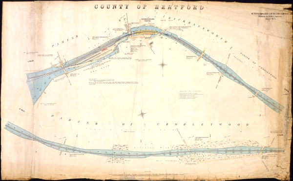
Sheet no. 5 of a map series produced in 1907 by the Metropolitan & Great Central Joint Committee for their route between Harrow and Verney Junction. Consisting of two one mile sections, these survey maps provided the companies with a detailed plan of the line and its infrastructure. The top section is a fine illustration of the relatively sharp bend on which Rickmansworth Station was built. The platforms are marked in yellow,with the station buildings in red. On the left is the station's small goods yard and coal wharf.
Digital Reference: L2679
Creator: Metropolitan and Great Central Joint Committee - 1907
Contributor: London's Transport Museum
Type: Photographed
Format: 600 dpi, 1070mm, 645mm
Copyright: London's Transport Museum
Source: London's Transport Museum (copy of Map)
Identifier: London's Transport Museum - 2003/ 12612


